Hello DOJO
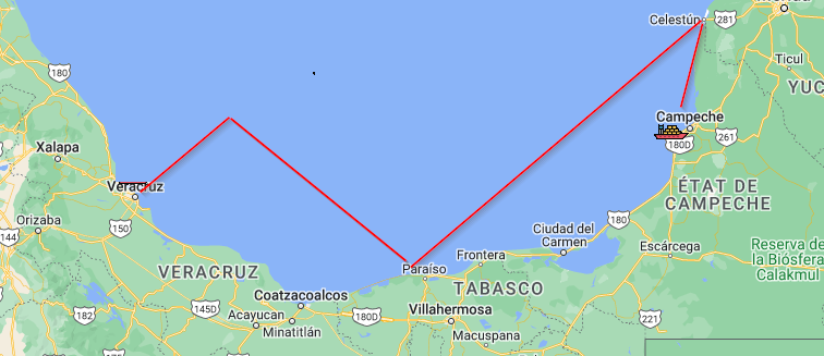
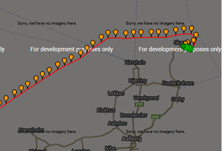
Is there a way to track ships or vehicles, by drawing lines on dataminer maps dashboard, based on trend values over longitude and latitude ?


I haven’t seen something speaking explicit of this in the documentation
DataMiner Maps | DataMiner Docs
Hi,
I’m not aware if it would be possible with trending, but there is something similar possible by working with so called logger tables. Logger tables are like parameter tables, but don’t store their values in memory (no alarming/trending) but directly in a database. More info about logger tables can be found here.
The coordinates are then written into such a logger table, every position is a new row in the logger table, and the DataMiner maps can then query that table to display the items.
Regards,
As a logger table is also available as parameter table, it can also be accessed like this: https://docs.dataminer.services/user-guide/Advanced_Modules/Maps/Layer_configuration_tags/TableSourceInfo.html , the advantage then is that there is no awareness needed of the DMA that is hosting the database nor do select queries need to be created. Downside compared with SqlSourceInfo is that it needs to pass some extra steps in the background so could be a bit slower and with SqlSourceInfo the query can be fully customized. Note: when using a logger table, do keep query restrictions into account based on the database architecture when defining the table structure (e.g. Cassandra is less flexible in querying compared to MySql)
Thank you both
I am going to read the docs you provided and make my tries
using Cassandra database model I am not sure if LAT,LON can be retrieved from data table to specified format
can someone advise?
More specific information on how to define the DataMiner Maps layer which will display the stored positions from the database table can be found here: https://docs.dataminer.services/user-guide/Advanced_Modules/Maps/Layer_configuration_tags/SqlSourceInfo.html