Hi,
I want to automatically position some elements on a map, based on coordinates. To proceed, I defined a single shape on vision with those properties:
Xpos [Parameter:site_lon]
Ypos [Parameter:site_lat]
Element 5302/2223
Info ELEMENT NAME
Parameters are labelled as per above but no shape appears ...
I tried the map when to display the element with a table using the same coordinates and it works fine, so I thing the map itself is ok. Do you have any suggestion?
And will it be possible to replace the element IP by [auto] or protocol to automatically position all elements alike?
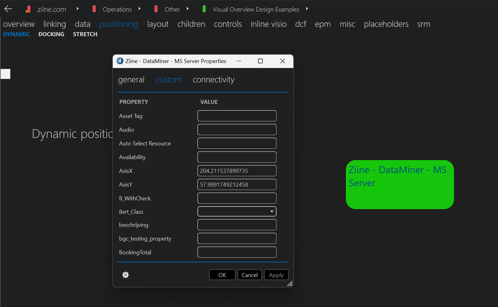
 Just as an additional note here on the topic for those who are interested: there is a sample implementation of this available on the online reference DataMiner System accessible with your Dojo account: https://ziine.skyline.be/ (along with other reference Visual Overview techniques)
Go to the view Operations > Other > Visual Overview Design Examples
And then to the tab page 'positioning' > DYNAMIC
There is an element there that is dynamically positioned. If you right click on the Visual Overview canvas and click 'arrange', you can drag the element to a new position and click Apply on the top right to store the new location. On the element you can right click > properties > custom where you can then see the AxisX and AxisY property that hold the positioning metrics.
Have you been able to solve the issue with these answers? If so, could you select the best answer (using the ✓ icon)? If not, you can also contact techsupport@skyline.be for assistance.