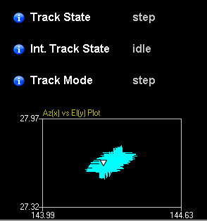
Some satellite antenna tracking system are able to display an history graph of the Elevation/Azimut of the Antenna.
The Azimut and Elevation are available on the driver but is it possible to display similar graph on the dataminer ?

Marieke Goethals [SLC] [DevOps Catalyst] Selected answer as best
Hi Bernard,
This isn’t available off the shelf.
However, if you would like to get creative you could create an ACU Manager that tracks the historical positions.
These historical points could be converted into a WPF Path markup.
Finally, you can build a graphical overview that shows the graph using the Path shape data property. (link to help)
Marieke Goethals [SLC] [DevOps Catalyst] Selected answer as best
We don’t have anything available to my knowledge.
You would have to build your own logic in the manager to achieve this.
Hi Ive,
Thanks for your help. Do you know if we have a script or other mecanism to convert trending data into WPF path ?