solution Use Case
DataMiner CityOps – Environmental Monitoring
Real-time environmental awareness for safer, smarter cities
The DataMiner CityOps Environmental Monitoring module empowers municipalities to manage environmental quality and weather conditions across micro-locations in the city. By combining data from local IoT sensors with external meteorological services, it delivers an integrated view of air quality, pollen levels, temperature, humidity, and noise. This enables precise situational awareness and proactive communication through the CityOps Communication Hub, ensuring that emergency services can respond quickly and citizens stay informed during critical events.
USE CASE DETAILS
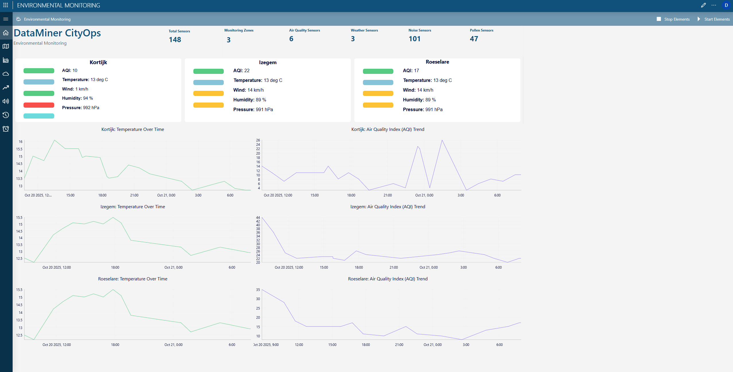
Environmental dashboard
This centralized dashboard aggregates key metrics from all monitoring zones. It provides real-time readings for temperature, humidity, air quality index, pressure, and wind speed across multiple city districts. Graphs display the evolution of temperature and air quality trends over time, allowing city operators to identify anomalies and predict deteriorating conditions before they escalate.
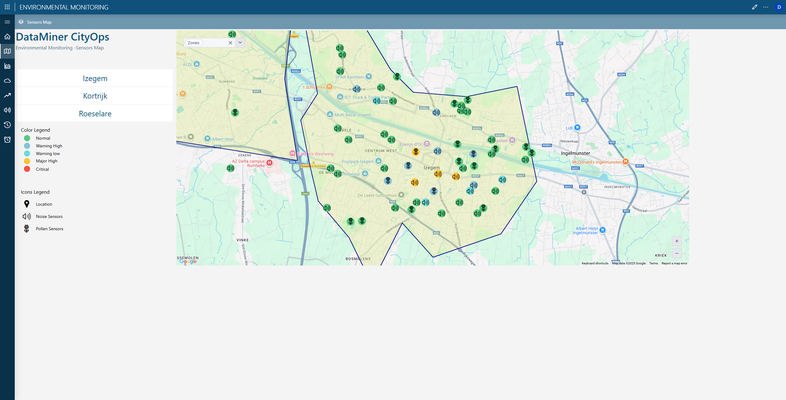
City map view
This page offers a geospatial overview of all environmental sensors across the urban area. Each icon represents a device category, such as noise or pollen sensors, while color codes indicate the current alert level—from normal to critical. Operators can zoom into specific neighborhoods to assess localized environmental stress and deploy targeted interventions like public alerts or maintenance checks.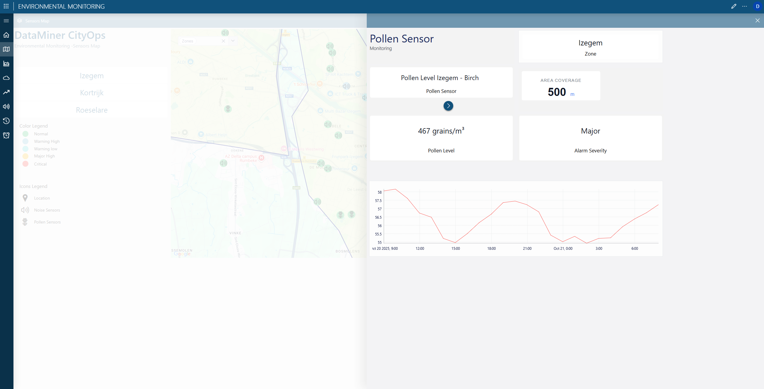
Pollen Monitoring panel
This panel focuses on pollen concentration levels at a granular level, tracking variations for different plant species across zones. Alerts indicate when pollen levels reach critical thresholds, enabling real-time communication with citizens prone to allergies. This micro-level data supports health departments in issuing location-specific advisories.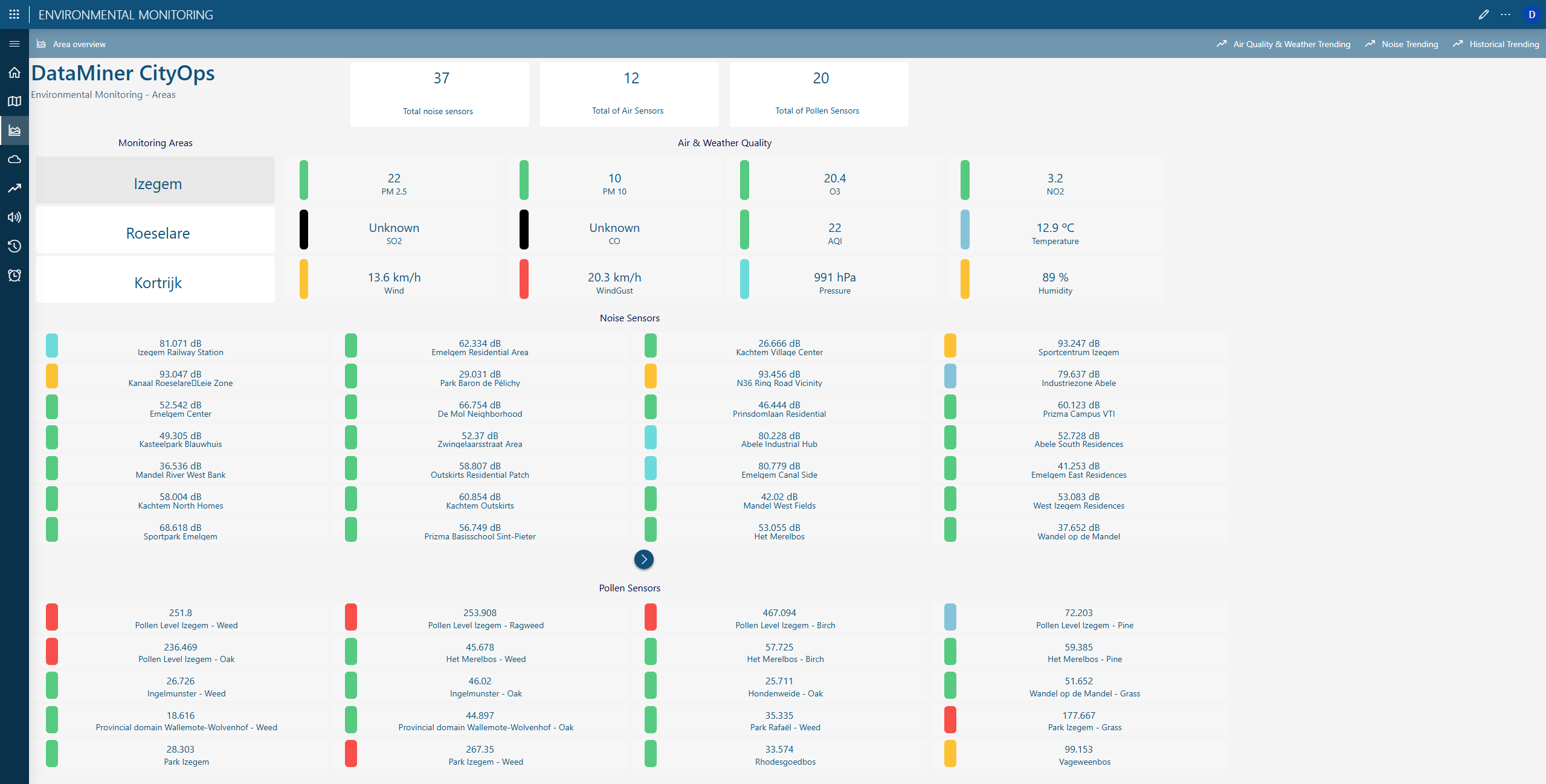
Area overview and sensor health
On this page, you’ll find an aggregated view of all air, weather, and noise sensors across monitored areas. Each section lists individual sensor values and current operational status. It ensures complete visibility of the sensing infrastructure, while enabling proactive maintenance and calibration to guarantee data accuracy and reliability.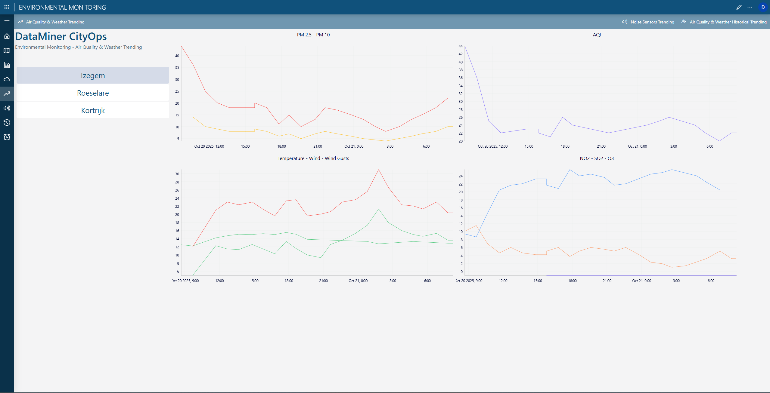
Air and weather trends
Historical trend graphs display air pollution parameters such as PM2.5, PM10, ozone, and nitrogen dioxide in correlation with weather factors like temperature and wind. These insights allow operators to understand the relationship between environmental conditions and air quality at specific times and locations, supporting data-driven environmental planning.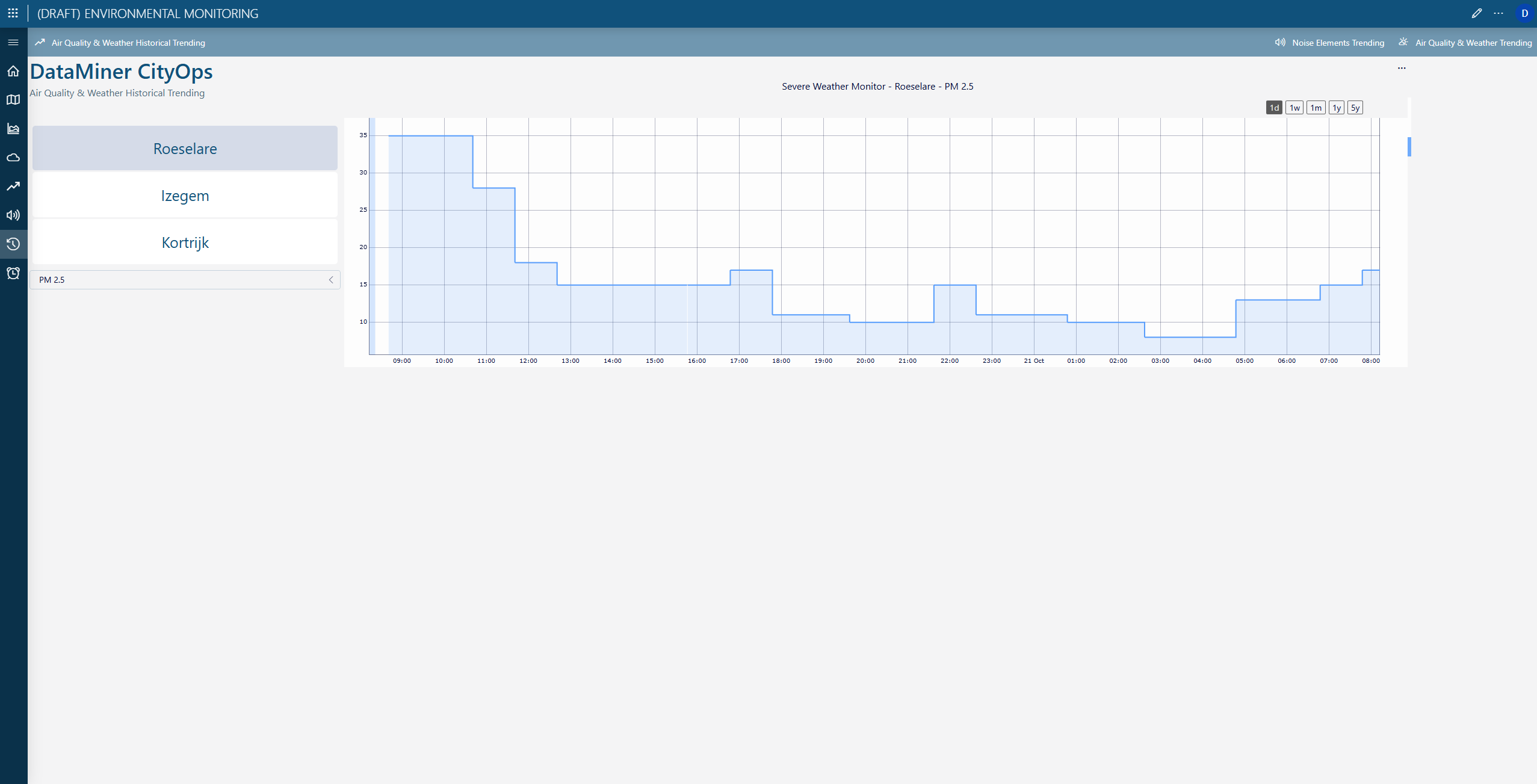
Noise monitoring trends
This visualization tracks sound levels from noise sensors across city zones. Operators can monitor the evolution of decibel levels in high-traffic or industrial areas to identify excessive noise exposure. This supports urban noise management initiatives and citizen well-being.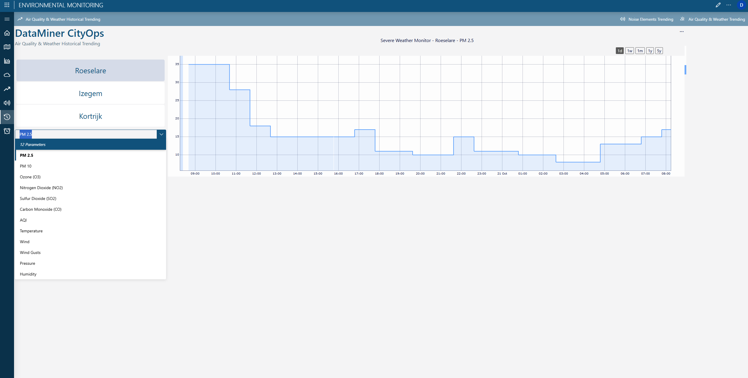
Severe weather and forecast trends
The app also includes dedicated panels for long-term environmental forecasting. These show historic and predictive patterns for pollutants and weather indicators, helping cities anticipate severe conditions. DataMiner integrates weather service forecasts to trigger alerts through the Communication Hub, ensuring coordination with the Emergency Response Command Center during extreme weather events.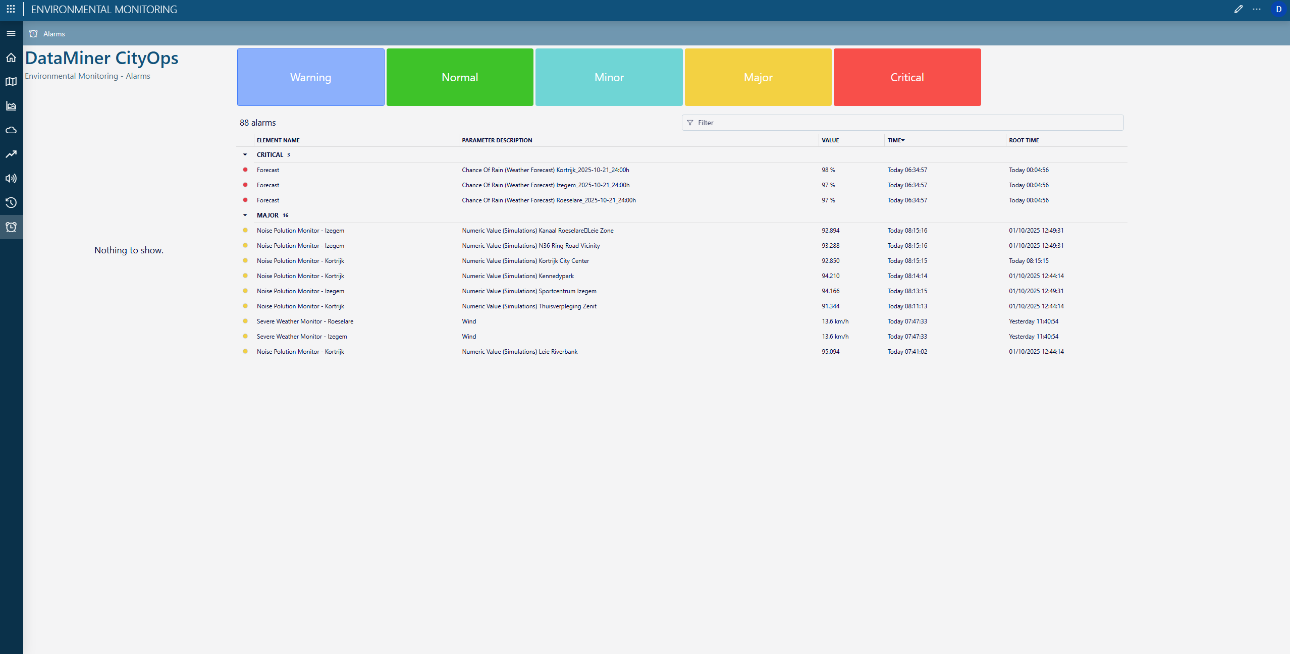
Alert management console
The final page of this app offers a consolidated view of all environmental alarms categorized by severity level (“warning”, “normal”, “minor”, ”major”, and “critical”). Automated workflows notify operators through communication channels, activating appropriate emergency protocols. This ensures rapid situational awareness and a synchronized city-wide response to environmental risks.Conclusion
CityOps Environmental Monitoring transforms how municipalities handle urban weather and environmental quality. It enables smarter resource allocation, faster emergency response, and improved citizen well-being. By combining real-time local sensor data with external weather services, it ensures precise micro-location weather management for each part of the city.The system helps cities maintain optimal air quality and noise levels while protecting public health during high-pollen or pollution events. It enhances urban resilience through predictive weather intelligence and enables faster communication with emergency services and citizens.